Cyclone Cody Likely Impacts on Coromandel
Written by John Grant on January 13, 2022
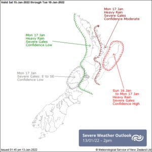
Tropical Cyclone Cody is moving towards New Zealand and MetService are forecasting very stormy weather to impact parts of the North Island and upper South Island. Impacts are likely to begin in the north on Sunday and move down the country. The Coromandel is expected to see large swells and plenty of rain over a 24 hour period.
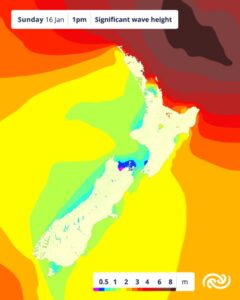
- WaveHeight – TCDC Emergency Management
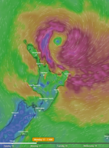
- Predicted wind 7am Monday
A ridge of high pressure currently over New Zealand gives another couple days of settled weather before Cyclone Cody is expected to bring damaging waves, gale force winds and heavy rain.
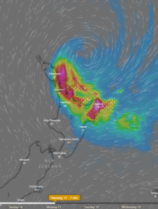
Exactly where the greatest impact from the expected gale force winds and heavy rain will be, is still uncertain but areas including Coromandel, Bay of Plenty, Gisborne and Hawke’s Bay look likely to bear the brunt of the storm. As the path of Cyclone Cody becomes clearer MetService will issue Severe Weather Watches and Warnings (by midday Friday) which will include more detail and likely impacts for each region.
Significant waves are expected to hit eastern coasts from Northland to Banks Peninsula during Saturday and Coromandel will see waves of 4 to 5 metres Monday and into Tuesday with inundation a serious risk for beachfront and low-lying areas.
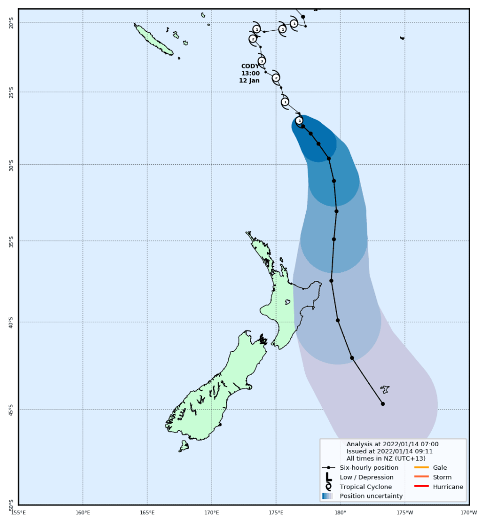
CAT 1 Tropical Cyclone (TC) Cody has moved south of latitude 25S today so MetService has taken over forecasting responsibility for the TC from Fiji Meteorological Service (TC position and tracks will be available on MetService.com). As Tropical Cyclone Cody sinks further south to affect the country it will encounter atmospheric conditions and sea surface temperatures which will change its structure to a mid-latitude low, at which stage we will refer to it as Cyclone Cody.
MetService Meteorologist April Clark warns, “Though Cyclone Cody will no longer be a Tropical Cyclone by the time it affects New Zealand, this doesn’t mean it will have lost any of its sting. Currently the exact path Cody will take over New Zealand during Sunday and Monday has significant variability, but it is clear that the upper two thirds of the country will see some form of severe weather from the system and the north and east will get large swell.”
- Predicted Rainfall
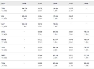
- Tide Times Whitianga
- Metservice Likely Impacts
The combination of high tides and swells possible of 4 to 5 metres are likely to see further erosion damage in vulnerable areas.
TCDC and MetService are asking people to share this information about Cyclone Cody with family and friends as many are still holidaying at beaches and camping sites. Please keep up with the latest forecasts and prepare to adjust your plans if your region is impacted by Cyclone Cody.
