Cyclone Cody Update for Friday 12 Noon – Cody tracking slightly East of Predicted Path
Written by John Grant on January 14, 2022
Here is our latest update.
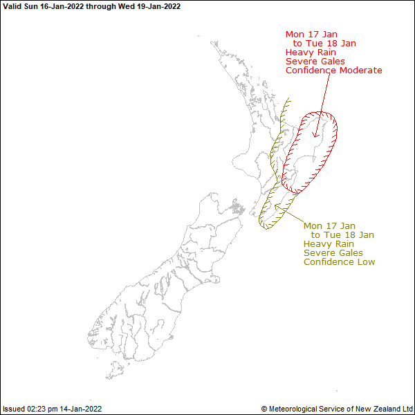
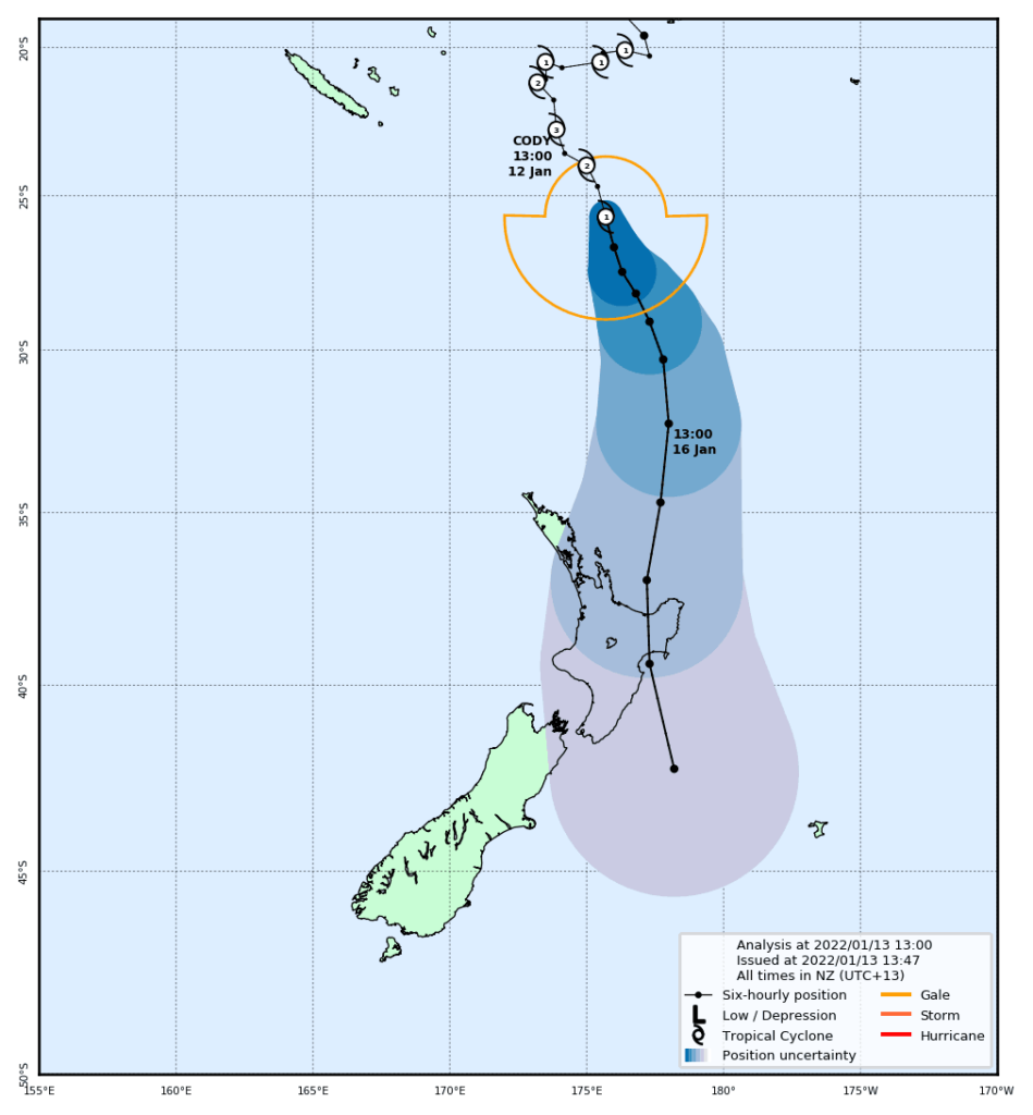
Yesterday our tracking was showing Cyclone Cody tracking to make landfall east of Whakatane. Today Cody has moved slightly east and now looks likely to miss New Zealand although it’s still a powerfull storm and the impact from Cody will still be felt here on the Coromandel.
We are awaiting an updated report from MetService that is due later this afternoon, however they spoke to Rick Rennie earlier today and said that the impact of ex Tropical Cyclone Cody would still be severe and to expect heavy rain, strong winds and waves of up to 4 metres.
As with any event of this size, circumastances can change and the ex tropical cyclone can change course. If that happens fresh updates will be issued. At this stage a watch is in place for the Bay of Plenty east of Whakatane and Gisbourne and Wairoa. No watches have so far been issued for the Coromandel.
Reader's opinions


Continue reading