No Mention of Coromandel in MetService Update
Written by John Grant on January 14, 2022
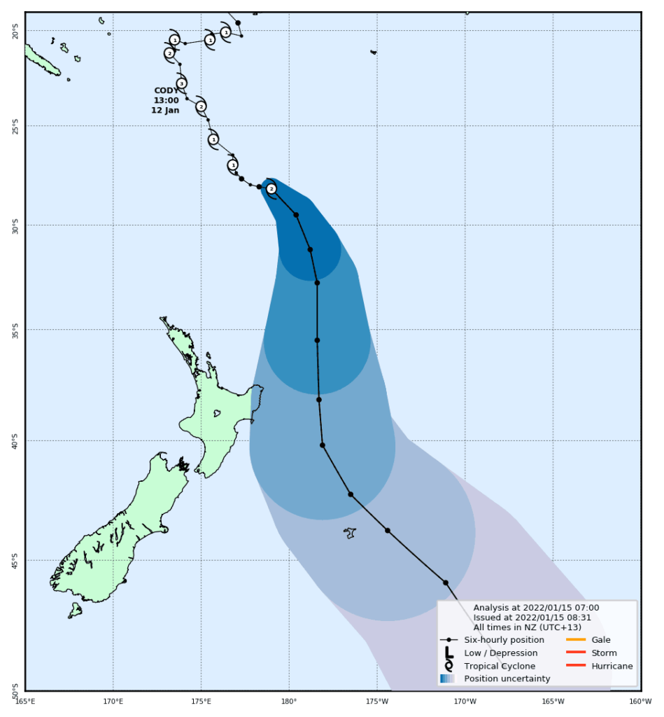
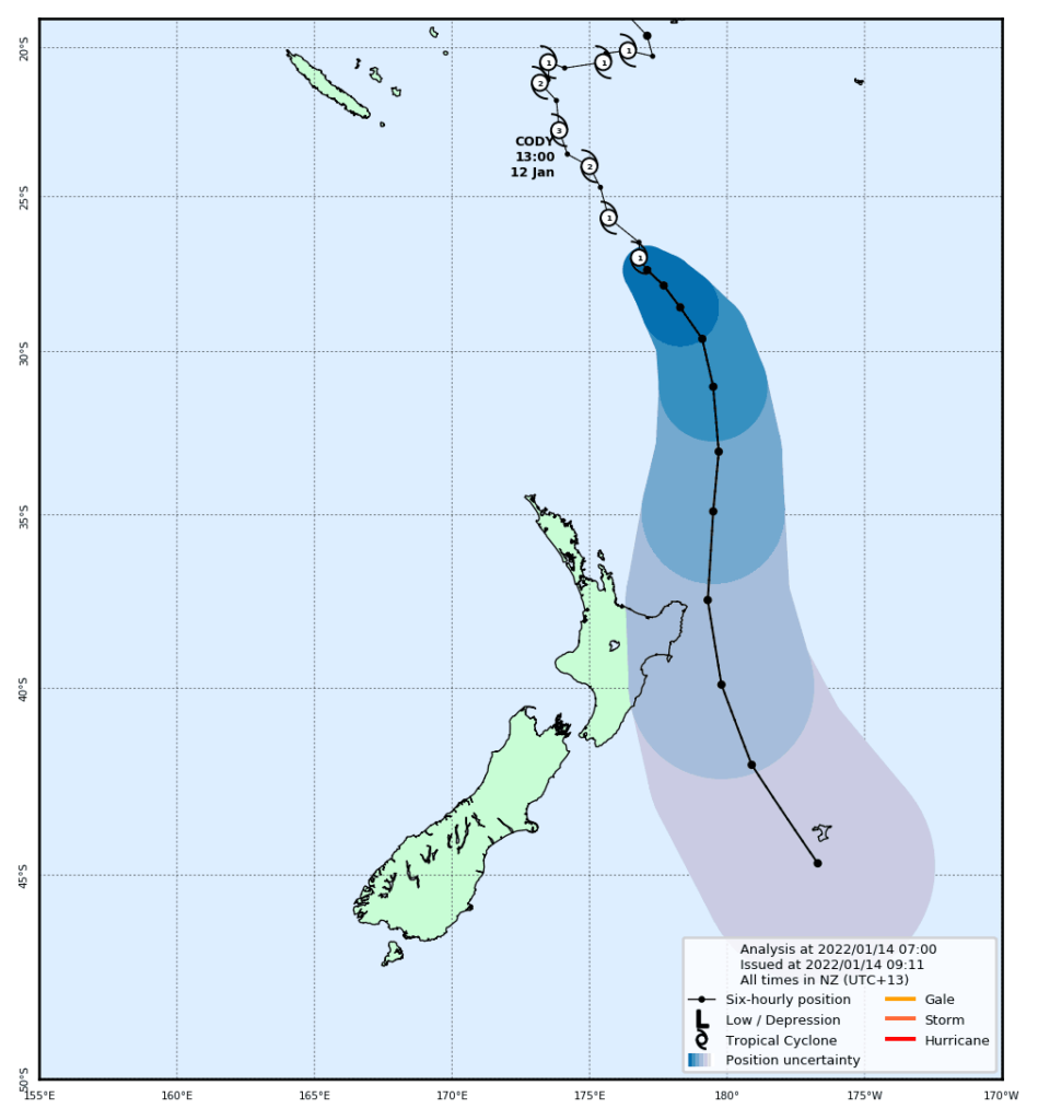
Here is the MetService Cyclone Cody report for Friday. There is no mention of Coromandel in the report but they still warn that the Cyclone can change direction at any time. Sizable swells are expected from this event.
Cyclone CODY is forecast to approach the waters north of the North Island overnight Sunday, then move near or across Gisborne on Monday, and across the Chatham Islands on Tuesday.
Gale and storm force winds about Cyclone CODY, both offshore and as it approaches the northeast of the North Island, will generate large easterly swells, significant sea surges/rips and coastal inundation about exposed eastern coastlines.
The cyclone is also accompanied by a tropical airmass, with a period of heavy rain expected for the east of the North Island. There is moderate confidence of rainfall reaching warning amounts and gales becoming severe over Hawke’s Bay, Gisborne and the far east of Bay of Plenty during Monday and early Tuesday. There remains some uncertainty regarding the track of Cyclone CODY, with low confidence of warning amounts of rain and severe gales for Bay of Plenty, Taupo, eastern Taihape and Wairarapa. Note, heavy rain and severe gales may affect the Chatham Islands during Tuesday and early Wednesday.
A front should then move across the South Island later Tuesday and Wednesday, bringing brief rain or showers.
Please note, there remains some uncertainty regarding the track of Cyclone CODY, and the areas that are going to be most impacted by this system. Small changes in the track may mean impacts could vary from place to place. Expert Meteorologists are closely monitoring the situation and people are advised to stay up to date with latest Severe Weather Watches or Warnings.
We will continue to update as more information comes through.