Still much uncertainty but be prepared for a week of heavy rain
Written by John Grant on April 29, 2023
MetService has issued a Heavy Rain Warning and a Strong Wind Watch for the Coromandel. Its been a relatively settled period of weather for the peninsula and it’s hard to believe that two months and 15 days have passed since the devastation of Cyclone Gabrielle. According to MetService, this coming event has aspects that are concerning in that it will be a prolonged weather system and there is still much uncertainty.
Local Civil Defence teams are on standby and TCDC issued a warning yesterday telling people to be prepared. NZTA also released a lengthy media statement that was asking drivers to “Drive to the conditions, expect the unexpected and watch following distances”. They also made a point of saying that many of the Coromandel Highways were already compromised and that further heavy rain will increase their vulnerability. Liam Ryan who is NZTA’s Journey Manager for the Waikato went on to say that drivers should expect surface flooding around the usual spots in Hikuai and at Wades Culvert in Whitianga. There may also be deterioration at existing slip sites or the formation of new slips. He says that roading contractors had put a huge effort into clearing the drainage system from earlier events and have inspected vulnerable flooding areas over the last few days of this last week. We will have teams out doing regular inspections of existing under-slip sites over the weekend to ensure there’s no significant risk to road users safety,” Mr Ryan says.
However a visit by CFM of the Wade Culvert this morning showed areas of debris still around the Culvert as can be seen in the below photos.
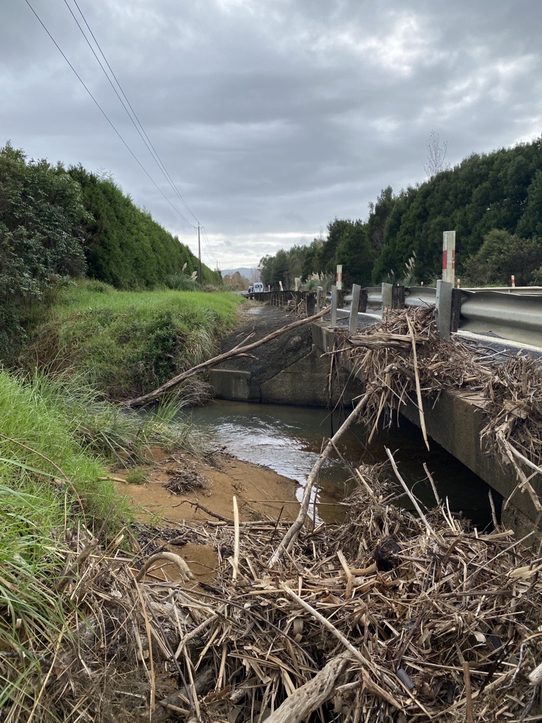
Wade Culvert Whitianga
NZTA also said that if rains falls as expected, then it is likely work will be delayed on the Manaia Hill and closures will not take place.
With winds expected to reach around 100 kph in coastal and exposed high locations, power systems will also be under pressure. Powerco is monitoring the situation and has field crews on call to respond to outages across its network, including Coromandel, which is expected to be impacted by the strong weather.
How you can prepare
Powerco suggests customers to secure trampolines and any outdoor furniture or equipment that can potentially be blown into overhead lines in high winds and cause outages. They also recommend that customers prepare for a potential outage by charging devices (laptops and phones) or having power banks ready, along with torches and topping up BBQ gas bottles if available.
More tips on preparing for a power outage are available on Powerco’s website here: powerco.co.nz/outages/being-prepared-for-a-power-outage
A further area of concern will be large swells that could be over 1.5m in Mercury Bay and over 2m in exposed eastern beaches. High tide on Sunday is around 3pm on the east coast and 3.25am and 3:53pm Monday. Many people in coastal properties will be looking out for more flooding and coastal erosion issues from this storm.
MetService have also said that this could be a prolonged heavy rain event and while the warning is for a 35 hour period, heavy rain could be around for most of the week although the duty forecaster said there is still considerable uncertainty on likely rain levels during the remainder of the week although the system does have a series of fronts and these will bring additional rain through to the end of this coming week.
CFM will be broadcast 30 minute updates during the duration of this weather event. You can hear them on the hour and half hour. We will also be publishing instant updates on road and general conditions so follow us on Facebook at facebook.com/CoromandelCfm. Also keep up to date on any issues with our roading network at cfm.co.nz/roads.
Reader's opinions


Continue reading