COROMANDEL ON ORANGE RAIN WARNING FROM 6PM TUEDAY EVENING
Written by John Grant on December 14, 2021
SEVERE WEATHER WARNING
Issued by MetService at 9:54 am Tuesday 14-Dec-2021
Heavy rain for parts of the North Island and upper South Island ,also northwest Tasman
A complex low pressure system affects central and northern New Zealand through to early Thursday, delivering rain to many places.
Heavy Rain Warnings and Watches are in force for parts of the North Island, northwest Tasman, and now including Canterbury and Marlborough.
People are advised to keep up to date with the latest forecasts in case any changes are made or further areas are added.
==========================
HEAVY RAIN WARNING – ORANGE
===========================
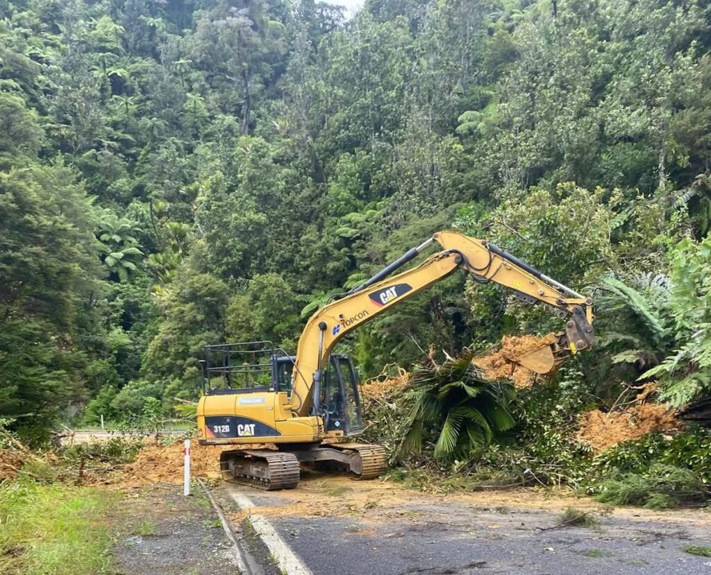
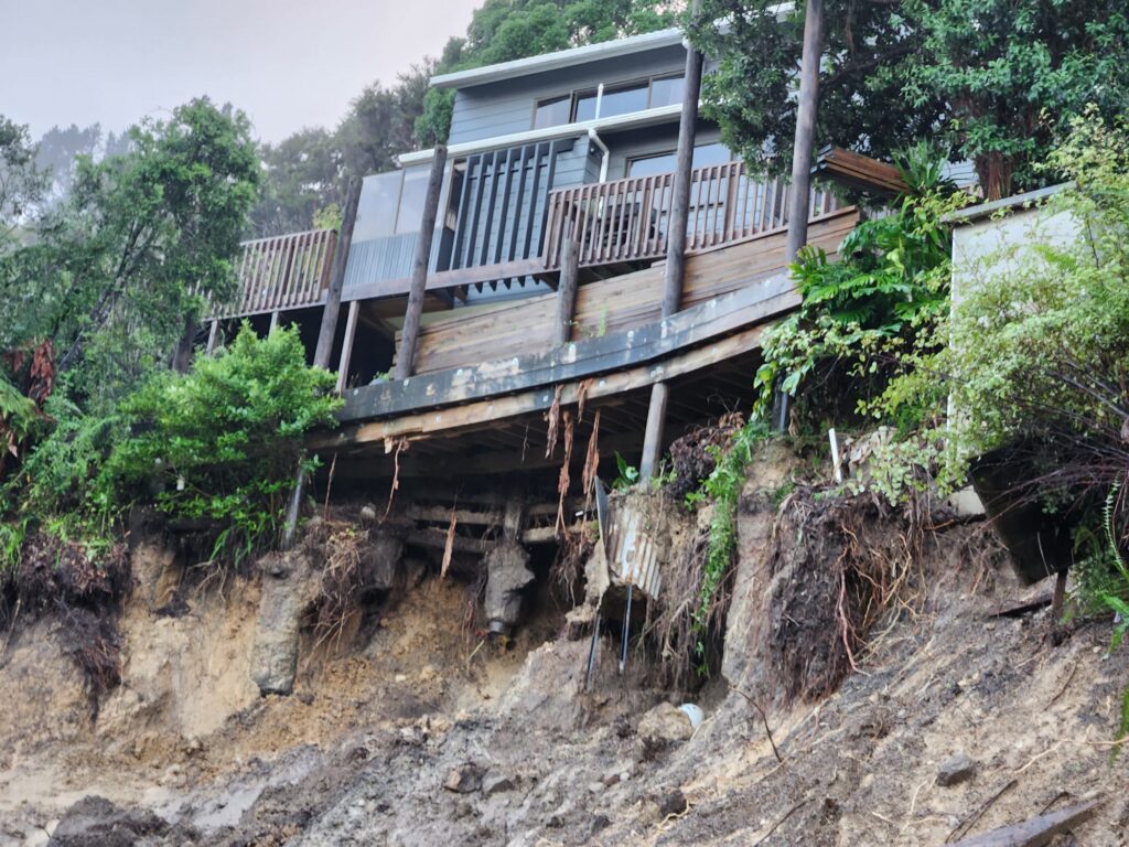
Heavy rain may cause streams and rivers to rise rapidly. Surface flooding and slips are also possible and driving conditions may be hazardous.
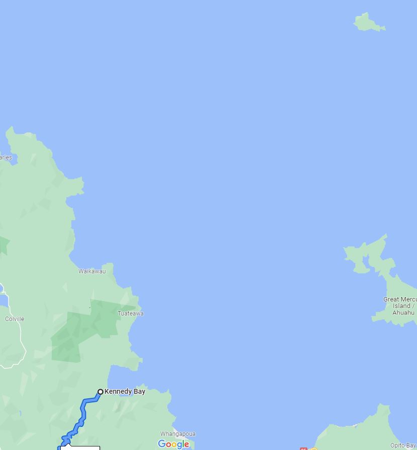
Area: Coromandel Peninsula
Valid: 12 hours from 6:00 pm Tuesday to 6:00 am Wednesday
Forecast: Periods of heavy rain. Expect 70 to 90 mm of rain to accumulate, especially about the ranges. Peak rates of 10 to 20mm/h about the ranges.
Change note: Upgraded to an Orange Warning.
Area: Bay of Plenty
Valid: 18 hours from 8:00 pm Tuesday to 2:00 pm Wednesday
Forecast: Periods of heavy rain. Expect 150 to 220 mm of rain to accumulate inland, especially about the eastern ranges, and 70 to 100 mm about the coast.Peak intensities of 20 to 30 mm/h inland during Wednesday morning.
Area: Gisborne from Tokomaru Bay northwards
Valid: 17 hours from 11:00 pm Tuesday to 4:00 pm Wednesday
Forecast: Periods of heavy rain. Expect 100 to 160 mm of rain to accumulate about the ranges, and 70 to 100 mm about the coast. Peak intensities of 15 to 25 mm/h about the ranges.
Change note: upgraded to an Orange Warning.
Area: Mount Taranaki
Valid: 2 hours from 9:00 am to 11:00 am Tuesday
Forecast: A further period of heavy rain. Expect 15 to 30 mm of rain to accumulate on top of what has already fallen. Peak intensities of
10 to 15 mm/h.
Area: Tasman, about and west of Motueka
Valid: 5 hours from 9:00 am to 2:00 pm Tuesday
Forecast: Expect a further 20 to 40 mm of rain to accumulate on top of what has already fallen. Peak intensities of 6 to 10 mm/h. Please note, another period of heavy rain is likely on Wednesday and a warning or watch may be issued for this possibility closer to the time.
Area: The Tararua Range
Valid: 4 hours from 9:00 am to 1:00 pm Tuesday
Forecast: Expect a further 20 to 40 mm of rain to accumulate on top of what has already fallen. Peak intensities of 10 to 15 mm/h.
Area: Eastern Marlborough
Valid: 19 hours from 1:00 am to 8:00 pm Wednesday
Forecast: Expect 100 to 180 mm of rain to accumulate, especially about Kaikoura Coast. Peak rates of 15 to 25 mm/h.
Area: Canterbury Plains north of Ashburton, including the foothills and Christchurch
Valid: 29 hours from 1:00 am Wednesday to 6:00 am Thursday
Forecast: Periods of heavy rain. Expect 110 to 160 mm of rain to accumulate,especially north of Christchurch. Peak rates of 15 to 25 mm/h.
Note, heavy rain is expected to ease north of Christchurch after midnight Wednesday.
Reader's opinions
Continue reading